
FolderDesa brings together practical knowledge on farming, village-owned enterprises, culinary traditions, rural tourism, and small-business ideas — all rooted in the everyday life of Indonesian villages.
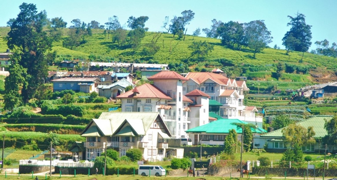
"From taro cultivation in Bogor to village tourism in Banyumas, every village has a story worth telling — and an opportunity worth sharing."
Seven areas of village knowledge
FolderDesa organizes its articles across these interconnected topics, each one grounded in real Indonesian village experience.
What you'll find on FolderDesa
Practical articles written by contributors who understand village life.
Agriculture & Cultivation
Articles on taro (talas bogor), dragon fruit, crystal guava, durian, oyster mushrooms, and tabulampot grapes — plus livestock such as dairy goats and Merino sheep.
Village-Owned Enterprises
Guides on establishing BUMDes, the differences from cooperatives, and why professional phased management matters for village economic growth.
Village Tourism
Coverage of destinations like Desa Karangkemiri in Banyumas, where outbound activities and a swimming pool helped tourism contribute Rp 50 million to village income in 2021.
Culinary Traditions
Indonesian village foods, Sundanese heritage dishes, spiced drinks, infused waters, seafood street-food ideas, and home-industry snack production.
Business Opportunities
From dried wood ear mushrooms and kopyor coconut seedlings to ecoprint crafting, bamboo crafts, and mina padi integrated rice-fish farming.
Village News & Community
Reports on social assistance programs like PKH, village governance structures, and practical tips such as safe homecoming travel during mudik season.
Building A Village Trail Map For Cyclists And Trekkers
A well-designed village trail map can turn ordinary paths into a useful community asset. It may guide cyclists past rice fields, lead trekkers to a spring or forest viewpoint, and help visitors find food stalls, homestays, workshops, and village-owned enterprises. More importantly, mapping makes local knowledge visible and gives residents a clearer basis for managing tourism.
For Indonesian villages, the best map is rarely a polished graphic produced from a desk. It grows from walking the route, speaking with farmers, checking seasonal conditions, and recording which places visitors may enter. Practical rural development stories and examples can be explored through the FolderDesa magazine, where village economies, local resources, and community initiatives are discussed in an accessible way.
Start With The Village Landscape
Begin by identifying the village’s main landscape features: farm tracks, irrigation channels, bamboo groves, river crossings, plantations, viewpoints, historic buildings, and gathering places. Mark facilities that make a journey comfortable, including toilets, water refill points, shelters, food stalls, prayer spaces, parking areas, and mobile signal locations.
A route should have a clear character. A short cycling loop might connect a market, rice terraces, a coffee producer, and a BUMDes office. A longer trekking route could follow a stream towards a waterfall, then return through farmland. Visitors need to know distance, estimated time, steep sections, surfaces, shade, and whether the track becomes muddy during the wet season.
Australian visitors are accustomed to checking distances and trail grades before setting out, whether walking in the Dandenong Ranges near Melbourne or cycling beside the Swan River in Perth. Use familiar descriptions such as easy, moderate, and difficult, but explain local conditions in plain language. A “moderate” village trail may include slippery paving, a narrow bamboo bridge, or a hot exposed section without shade.
Gather Accurate Local Information
The first survey should be completed on foot and by bicycle, preferably with residents who use the paths every day. Record GPS points with a mobile phone, take photographs in both directions, and note junctions where a visitor could become confused. Farmers can identify private land, seasonal planting areas, and paths that are unsuitable during harvesting.
Mapping local resources is more useful when it includes relationships rather than isolated points. A spring may supply a food stall, a forest path may be maintained by a youth group, and a traditional kitchen may depend on produce from nearby gardens. A practical resource mapping guide can help a village organise these details before choosing which attractions to promote.
Check every proposed stop with its owner or manager. A home kitchen may welcome small groups but not large tour buses. A sacred site may be visible from a public path but closed to visitors. Consent, access hours, photography rules, and appropriate clothing should be recorded before the route is published.
Design Routes For Different Users
Cyclists and trekkers do not experience a route in the same way. Cyclists need information about road width, gradients, loose gravel, drainage dips, traffic, repair points, and places where bicycles can be safely left. Trekkers need details about footwear, stream crossings, slippery roots, shade, toilets, and the time required to return before dark.
Create several route types instead of presenting one long journey. Useful options include:
- A family loop of two to five kilometres
- A half-day farm and food route
- A forest trek with a trained local guide
Use colour coding and simple symbols on the printed and digital versions. Include a scale, north arrow, emergency contact number, meeting point, and a note about weather. QR codes can link to updated route conditions, but the physical map remains important when batteries fail or mobile coverage disappears.
Australian trail users often carry water, apply sunscreen, and expect clear warnings about fire danger. Indonesian villages can adapt that habit by adding advice about heat, rain, leeches, river levels, and motorbike traffic. During Australia’s bushfire season, parks may close tracks at short notice; similarly, village maps should show that landslides, flooding, ceremonies, or farm work can temporarily change access.
Make Safety And Permission Visible
Safety information should be specific rather than alarming. Identify sections with steep drops, fast-flowing water, aggressive dogs, unstable bridges, or poor lighting. Tell visitors whether they must remain with a guide. A simple emergency protocol can list the nearest clinic, village office, police post, and transport contact.
Land access requires careful attention. A path may cross private gardens, customary land, forestry areas, or a conservation zone. In Australia, route organisers commonly check council permissions, state park regulations, public liability insurance, and Aboriginal cultural heritage obligations. Indonesian villages also need to clarify land rights, cultural protocols, and responsibilities among the village government, landowners, BUMDes, and tourism groups.
Avoid marking sensitive sites too precisely if publicity could damage them. A nesting area, medicinal plant grove, or sacred location may be better described as a protected zone than as a visitor attraction. Signage should use respectful language and, where useful, Indonesian, English, and the local language.
Study other community-led place-making examples for ideas about signs, small businesses, and visitor flow. The Fukushima shopping streets project, for instance, shows how local identity and everyday commerce can be presented together rather than treating tourism as separate from community life.
Connect The Map To Village Income
A trail becomes economically valuable when visitors can spend time and money locally without turning the village into a stage set. List food vendors, coffee growers, craft makers, guides, homestays, bicycle repairers, and transport providers. Set transparent prices and explain what each fee supports, such as path maintenance, waste collection, or guide training.
A printed map can be sold at the village office, market, homestay, and trailhead. Digital versions should show opening hours and a contact number, but those details need regular checking. In Australia, weekend markets and cycle trails often work well because visitors can combine recreation with a meal or local purchase. Indonesian villages can build a similar rhythm around warung meals, seasonal produce, village festivals, and demonstrations of traditional cooking.
Before launching, test the map with people who do not know the area. Ask them to follow the route without being guided and note where they hesitate. Then walk the route after heavy rain and during a busy farming period. Remove inaccurate attractions, repair confusing signs, and record the date of the latest update.
A successful trail map is a working agreement as much as a navigation tool. It shows where visitors may go, who maintains each section, and how local benefits are shared. The practical takeaway is to survey routes with residents, publish honest difficulty and access information, and update the map whenever the landscape, weather, or community permissions change.

Questions or story ideas from your village?
FolderDesa welcomes readers who want to share village experiences or learn more about the topics covered on the site.
Visit the Contact Page