
FolderDesa brings together practical knowledge on farming, village-owned enterprises, culinary traditions, rural tourism, and small-business ideas — all rooted in the everyday life of Indonesian villages.
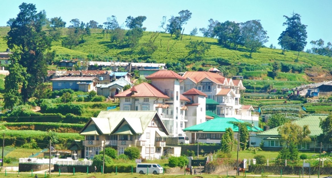
"From taro cultivation in Bogor to village tourism in Banyumas, every village has a story worth telling — and an opportunity worth sharing."
Seven areas of village knowledge
FolderDesa organizes its articles across these interconnected topics, each one grounded in real Indonesian village experience.
What you'll find on FolderDesa
Practical articles written by contributors who understand village life.
Agriculture & Cultivation
Articles on taro (talas bogor), dragon fruit, crystal guava, durian, oyster mushrooms, and tabulampot grapes — plus livestock such as dairy goats and Merino sheep.
Village-Owned Enterprises
Guides on establishing BUMDes, the differences from cooperatives, and why professional phased management matters for village economic growth.
Village Tourism
Coverage of destinations like Desa Karangkemiri in Banyumas, where outbound activities and a swimming pool helped tourism contribute Rp 50 million to village income in 2021.
Culinary Traditions
Indonesian village foods, Sundanese heritage dishes, spiced drinks, infused waters, seafood street-food ideas, and home-industry snack production.
Business Opportunities
From dried wood ear mushrooms and kopyor coconut seedlings to ecoprint crafting, bamboo crafts, and mina padi integrated rice-fish farming.
Village News & Community
Reports on social assistance programs like PKH, village governance structures, and practical tips such as safe homecoming travel during mudik season.
Creating A Village Tourist Map That Visitors Can Use
A well-made village tourist map does more than show roads. It helps visitors understand where to arrive, what to see, how long activities take, and which local businesses deserve their spending. For an Indonesian village, the map can connect rice fields, craft workshops, food stalls, homestays, temples, rivers, viewpoints, and community-run attractions into one clear visitor experience. Learn more about 270105 Aitoredingubottono Huo Yong Shu Li Yiwo Zui Da Huasuru Zhan Lue.
Australian travellers are often comfortable using Google Maps, QR codes, and self-guided routes, but they still value information that feels practical and trustworthy. A map that explains walking conditions, toilet access, mobile coverage, opening times, and local etiquette can make a rural visit easier for families, grey nomads, school groups, and independent travellers.
Start With The Village Story
Before placing icons on a map, decide what story the village wants to share. A farming village might centre its route on irrigation, seasonal crops, traditional kitchens, and a morning market. Another community may focus on bamboo craft, river activities, heritage houses, or a sacred site where visitors need guidance from local residents.
The strongest map usually has a simple theme rather than a long list of unrelated attractions. Create a few connected trails, such as a two-hour food and culture walk, a half-day farm experience, or a scenic cycling loop. This gives visitors a reason to move between points of interest and helps local operators benefit from shared foot traffic.
Gather Accurate Information On The Ground
Begin with a village walk involving residents, youth groups, guides, traders, and officials. Record each location with a phone, noting its name, entrance, facilities, best visiting time, likely hazards, and the person responsible for updates. A small warung may be easy for locals to recognise but difficult for an overseas visitor to find, so add a landmark and a short description.
Check distances in realistic conditions. A route that looks short on a screen may include a steep path, slippery stones, a busy road crossing, or a narrow bridge. Australian visitors who are used to marked bushwalking tracks around the Blue Mountains or the Dandenong Ranges will appreciate honest notes about terrain, footwear, shade, and walking time.
Ask permission before publishing private homes, sacred spaces, children’s activities, or culturally sensitive locations. A village map should support community control, especially when visitors enter places that are not designed as unrestricted tourist attractions.
Choose A Format Visitors Can Read Quickly
Use a clean base map with a limited number of symbols. Mark transport access, parking, toilets, prayer facilities, food, accommodation, emergency help, and attractions in separate colours. Avoid filling the page with every lane; too much detail can hide the route visitors actually need.
Prepare both a printable version and a mobile-friendly version. A downloadable PDF is useful when the signal is weak, while a Google Maps layer or QR-linked page can support live navigation. Add a scale, north arrow, contact number, opening hours, language support, and the date of the latest update. A clear legend matters as much as the artwork.
A village with bamboo structures or handmade signage can reflect that identity in the visual design. Practical guidance on bamboo construction can also help a community create attractive, low-cost map boards, shade shelters, or trail markers that suit the local landscape.
| Map Format | Best Use | Strength | Limitation |
|---|---|---|---|
| Printed A3 map | Welcome desks, markets, homestays | Easy to view and share | Needs regular reprinting |
| Folded pocket map | Walking tours and day trips | Portable and inexpensive | Limited space for detail |
| QR-linked web map | Independent travellers | Can include photos and updates | Depends on phone battery and signal |
| Signboard map | Village entrance and parking | Visible before a visit begins | Cannot provide changing information |
| Guide-led route map | Cultural and farm experiences | Adds local explanation and safety | Requires trained guides |
Design For Australian Visitor Habits
Australian travellers often plan around weekends, school holidays, and public-holiday breaks. They may compare a village attraction with a national park, farmers market, or regional food trail, so the map should state the experience length and suitable audience. Labels such as “family-friendly,” “best before 10 am,” or “requires advance booking” are more useful than promotional phrases.
Show practical details that influence spending decisions: whether payment is cashless, whether an Australian bank card is likely to work, where to refill water, and whether a visitor can hire a motorbike or local driver. A$ prices can be shown alongside Indonesian rupiah for package tours or entrance fees, while a note should explain that exchange rates change.
Use plain English for the visitor version, while keeping Indonesian names intact. “Village kitchen,” “rice-field walk,” and “craft demonstration” are usually clearer to overseas visitors than literal translations that lack context. A short pronunciation guide can make conversations friendlier and encourage visitors to use local greetings.
Connect The Map With Local Enterprise
A tourist map becomes economically valuable when each point has a clear relationship with village-owned enterprises, farmers, guides, and small traders. A rice-field walk can lead to a cooking class; a waterfall route can finish near a snack stall; a craft workshop can offer products that visitors can carry home. This spreads income instead of concentrating every sale at one entrance gate.
List businesses fairly and set simple inclusion rules. For example, an operator may need a visible price list, safe premises, reliable opening hours, and agreement with village tourism managers. Rotate featured businesses when appropriate, and make it clear whether a service is community-run, privately owned, or managed by BUMDes.
Research into a digital mapping approach can help the team think about updates, audience data, and online distribution without making technology the centre of the project.
Useful information to display for visitors includes:
- Opening hours and booking requirements
- Price, payment method, and minimum group size
- Walking time, terrain, and accessibility
- Contact details for guides or homestays
Local operators can prepare the map for business growth by:
- Adding a consistent name and location pin
- Photographing products in natural village settings
- Recording seasonal activities and harvest periods
- Linking suitable enterprises through a shared route
Publish, Test, And Keep It Current
Test the map with people who do not know the village. Invite a visitor from a nearby town, an English-speaking resident, and a local family to follow one route without verbal help. Note where they hesitate, take a wrong turn, or cannot find the promised facility. Their confusion reveals problems that local residents may overlook.
Place printed copies at the village entrance, homestays, cafés, transport stops, tourist information counters, and nearby attractions. A QR code can lead to a page with updated phone numbers and seasonal notices. Promotion through a village business directory can further connect the map with accommodation, food, transport, and activity providers.
Assign one person or small committee to review the map each month during the first season. Check closed businesses, damaged signs, road changes, flood conditions, prices, and new attractions. After major rain, festivals, or infrastructure work, update the route before promoting it again.
The finished map should be treated as a working village asset rather than a one-off design project. Its practical test is simple: a visitor can find the village, follow a safe route, understand what is available, and spend money with confidence. Record that route, those access details, and the latest contact information in one easy-to-update file.

Questions or story ideas from your village?
FolderDesa welcomes readers who want to share village experiences or learn more about the topics covered on the site.
Visit the Contact Page