
FolderDesa brings together practical knowledge on farming, village-owned enterprises, culinary traditions, rural tourism, and small-business ideas — all rooted in the everyday life of Indonesian villages.
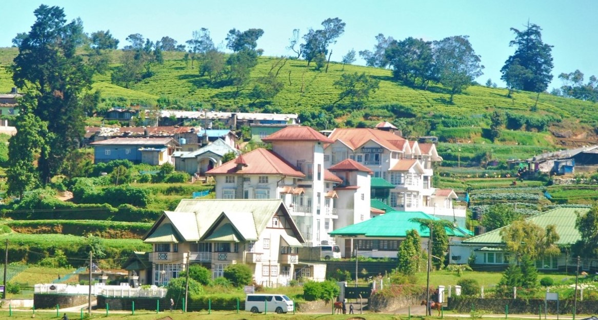
"From taro cultivation in Bogor to village tourism in Banyumas, every village has a story worth telling — and an opportunity worth sharing."
Seven areas of village knowledge
FolderDesa organizes its articles across these interconnected topics, each one grounded in real Indonesian village experience.
What you'll find on FolderDesa
Practical articles written by contributors who understand village life.
Agriculture & Cultivation
Articles on taro (talas bogor), dragon fruit, crystal guava, durian, oyster mushrooms, and tabulampot grapes — plus livestock such as dairy goats and Merino sheep.
Village-Owned Enterprises
Guides on establishing BUMDes, the differences from cooperatives, and why professional phased management matters for village economic growth.
Village Tourism
Coverage of destinations like Desa Karangkemiri in Banyumas, where outbound activities and a swimming pool helped tourism contribute Rp 50 million to village income in 2021.
Culinary Traditions
Indonesian village foods, Sundanese heritage dishes, spiced drinks, infused waters, seafood street-food ideas, and home-industry snack production.
Business Opportunities
From dried wood ear mushrooms and kopyor coconut seedlings to ecoprint crafting, bamboo crafts, and mina padi integrated rice-fish farming.
Village News & Community
Reports on social assistance programs like PKH, village governance structures, and practical tips such as safe homecoming travel during mudik season.
How to develop a village walking trail map
A well-designed village walking trail map can turn ordinary paths, farms, riversides, and neighborhood lanes into a clear visitor experience. It helps guests understand where to go, what to see, how long a route takes, and which local businesses or community sites are worth visiting.
For Indonesian villages, mapping is also a practical development tool. A route can connect cultural heritage with farm activities, traditional food, homestays, craft workshops, and village-owned enterprises (BUMDes). When planned with residents, the map reflects the real character of the village instead of presenting a generic tourism route.
The process does not require expensive software at the beginning. A paper sketch, smartphone GPS, local knowledge, and a small group of residents can provide enough information for a useful first version. Accuracy, safety, and easy-to-read directions matter more than elaborate graphics.
Define the route experience
Start by deciding what visitors should experience during the walk. A village trail might focus on rice fields, traditional houses, irrigation channels, religious landmarks, home industries, river ecology, or local history. Combining too many themes can make the route confusing, so choose one main story and a few supporting attractions.
Walk the area with farmers, elders, youth representatives, tourism managers, and business owners. Ask which paths are used regularly, which places have cultural meaning, and which locations are suitable for visitors. A narrow footpath may be attractive in dry weather but unsafe after heavy rain, while a quiet lane may pass close to homes where privacy needs to be respected.
Create a simple route concept before measuring every detail. For example, a 2-kilometer heritage loop may take 60 to 90 minutes because it includes stops for storytelling and photographs. A longer agricultural route can offer a deeper experience but should include rest points, shade, and an alternative return path.
Gather accurate location information
Use a smartphone mapping application or handheld GPS device to record the route while walking it. Save the track from the starting point to each attraction, entrance, rest area, toilet, parking space, and emergency access road. Take photographs at turns and record short notes about landmarks that may not appear on digital maps.
Measure practical details as well as distance. Note steep sections, slippery surfaces, stream crossings, poor mobile signal, lighting conditions, and seasonal changes. A route that is comfortable in the morning may become hot at midday, and a path beside a river may be inaccessible during the rainy season.
Verify names and coordinates with local residents before publishing. Place names can have different spellings, and an attraction may be known by a local name rather than its official administrative name. Review the route with village officials so the map does not show private land, restricted areas, or paths without permission.
Organize landmarks and visitor information
Every stop on the walking route should have a clear purpose. Useful categories include cultural sites, natural features, food vendors, agricultural activities, viewpoints, sanitation facilities, water points, prayer spaces, and emergency locations. Give each point a short description that explains why it matters and how much time visitors may need.
Food can become an important part of the walking experience when it is connected to local producers. Link the route to a reliable local food guide so visitors can discover village dishes before or after the walk. Vendors should provide opening hours, prices, ingredients, and advance-order information where possible.
Do not overload the map with long historical text. Use short labels, numbered stops, and a separate guide for fuller stories. If a household produces traditional snacks, handicrafts, or farm products, explain whether visitors can watch production, purchase goods, or need to arrange a visit in advance.
Choose a format people can use
A printed map remains valuable in rural areas where internet access or mobile signals are uneven. Use a large title, a clear starting point, directional arrows, estimated walking times, and recognizable landmarks. Include a scale, north arrow, emergency contact, opening hours, and a note about appropriate footwear or weather conditions.
A digital version can use a QR code that opens a map application, downloadable route file, or village tourism webpage. Keep the digital route simple enough for older phones, and test the QR code from several locations. Do not assume every visitor knows how to follow a GPS track, so signs and written directions should support the digital option.
| Map element | What to include | Why it matters |
|---|---|---|
| Route line | Main path, optional shortcut, distance, walking time | Helps visitors judge effort |
| Landmark markers | Attractions, food stalls, toilets, rest points | Makes the journey easier to follow |
| Safety details | Slippery areas, steep sections, crossings, emergency access | Reduces avoidable risk |
| Local services | Guides, homestays, shops, BUMDes contacts | Connects tourism with income |
| Access information | Parking, public transport, trail opening hours | Supports trip planning |
| Update date | Month and year of the latest review | Shows whether information is current |
Build safety and maintenance into the map
A trail map should communicate risks honestly. Mark steep slopes, unguarded edges, slippery stones, livestock areas, and sections that become flooded. If a route is unsuitable for wheelchairs, strollers, young children, or visitors with limited mobility, state that clearly and provide a more accessible alternative when available.
Install signs only where they solve a real navigation problem. Direction arrows at junctions, stop numbers, distance markers, and simple etiquette reminders are usually more helpful than large decorative boards. Use weather-resistant materials and place signs where they do not block agricultural work or damage trees.
Assign responsibility for maintenance before promoting the route. A BUMDes, tourism awareness group, youth organization, or village government team can check signs, clear vegetation, update business information, and report damaged paths. A monthly inspection during the rainy season may be necessary, while attraction details should be reviewed whenever a business changes its schedule.
Connect the trail with local income
A walking route creates stronger economic value when visitors have meaningful reasons to stop and spend locally. Coordinate with food sellers, guides, farmers, craft makers, parking attendants, homestays, and village transport providers. Set fair service standards so guests receive consistent prices and clear information.
Small producers can become memorable trail stops when the experience is organized. A snack workshop, for example, may offer a short demonstration followed by product sales; information about the sticky rice snacks business can help local groups think through production and marketing. Visitors should know whether a demonstration is free, scheduled, or limited to small groups.
Track simple results after launch: visitor numbers, average time on the trail, purchases from local businesses, complaints, damaged facilities, and repeat visits. These figures help the village improve the route without relying on assumptions. Protecting residents’ privacy and preventing litter should remain as important as increasing visitor spending.
Test, launch, and update the map
Before publicizing the walking trail, invite several test groups with different needs. Include residents who know the area, first-time visitors, older walkers, families, and someone unfamiliar with map symbols. Ask them to complete the route without constant assistance and record every place where they hesitate.
Use their feedback to correct distances, labels, route arrows, and safety notes. Test the printed map in bright sunlight and check whether text remains legible at a practical size. Test the digital version with mobile data turned off if the trail may pass through areas with weak coverage.
Use these actions to prepare the first public version:
- Select one manageable route rather than mapping the entire village at once.
- Record the path, landmarks, facilities, hazards, and seasonal changes.
- Confirm land access, business details, names, and emergency contacts.
- Produce both a printed map and a lightweight digital route.
- Assign a local team to inspect and update the trail regularly.
A pilot launch can begin with a village walking day, school activity, or small guided tour. Collect comments through a sign-in book or simple online form, then publish the revised map with its update date. A map that changes with the village will remain useful long after the first tourism campaign ends.
Start by walking one route with the people who know it best, then turn their knowledge into clear directions, useful visitor information, and fair opportunities for local businesses. With regular testing and maintenance, a village walking trail map can become a practical guide for visitors and a lasting tool for community development.

Questions or story ideas from your village?
FolderDesa welcomes readers who want to share village experiences or learn more about the topics covered on the site.
Visit the Contact Page