
FolderDesa brings together practical knowledge on farming, village-owned enterprises, culinary traditions, rural tourism, and small-business ideas — all rooted in the everyday life of Indonesian villages.
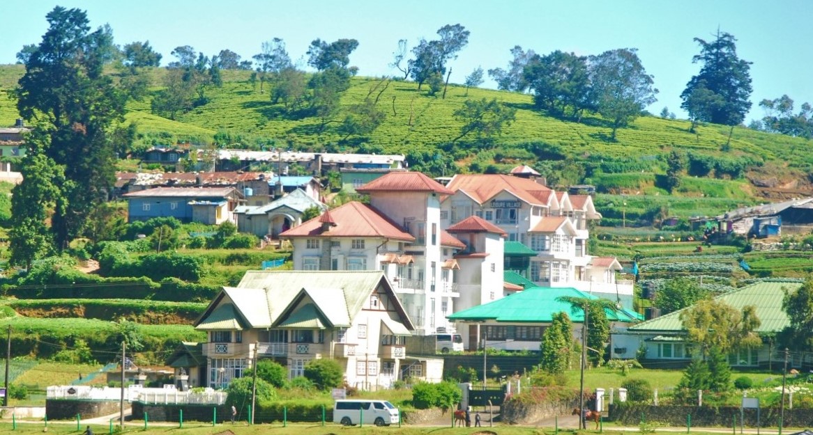
"From taro cultivation in Bogor to village tourism in Banyumas, every village has a story worth telling — and an opportunity worth sharing."
Seven areas of village knowledge
FolderDesa organizes its articles across these interconnected topics, each one grounded in real Indonesian village experience.
What you'll find on FolderDesa
Practical articles written by contributors who understand village life.
Agriculture & Cultivation
Articles on taro (talas bogor), dragon fruit, crystal guava, durian, oyster mushrooms, and tabulampot grapes — plus livestock such as dairy goats and Merino sheep.
Village-Owned Enterprises
Guides on establishing BUMDes, the differences from cooperatives, and why professional phased management matters for village economic growth.
Village Tourism
Coverage of destinations like Desa Karangkemiri in Banyumas, where outbound activities and a swimming pool helped tourism contribute Rp 50 million to village income in 2021.
Culinary Traditions
Indonesian village foods, Sundanese heritage dishes, spiced drinks, infused waters, seafood street-food ideas, and home-industry snack production.
Business Opportunities
From dried wood ear mushrooms and kopyor coconut seedlings to ecoprint crafting, bamboo crafts, and mina padi integrated rice-fish farming.
Village News & Community
Reports on social assistance programs like PKH, village governance structures, and practical tips such as safe homecoming travel during mudik season.
How to create a village map with local landmarks
A village map is more than a drawing of roads and boundaries. It can show where people live, where farmers work, which paths lead to rivers, and where visitors can find cultural, natural, and economic attractions. When built with local knowledge, the map becomes a practical guide for residents and guests.
A clear map also supports village planning. Officials can use it to identify underserved areas, entrepreneurs can locate business opportunities, and community groups can document places with historical or cultural value. The process does not require expensive equipment at the beginning; careful observation, discussion, and basic digital tools are often enough.
The strongest results come from combining geographic information with stories from residents. A spring may be a water source, a meeting place, and part of a local legend. Recording these details gives the map greater meaning and makes it more useful for development, education, and rural tourism.
Define the purpose and audience
Begin by deciding why the map is being created. A tourism map may highlight viewpoints, craft centers, food stalls, homestays, traditional ceremonies, and walking routes. A planning map may focus on irrigation channels, public facilities, farm access roads, drainage, and settlement expansion.
The intended users determine the amount of detail required. Visitors need recognizable landmarks, simple symbols, transport information, and safety notes. Village officials may need administrative boundaries, land-use zones, public assets, and infrastructure. Farmers may benefit from information about field paths, water sources, storage buildings, and markets.
Write the main purpose in one sentence before collecting data. This prevents the project from becoming crowded with unrelated information and helps the team decide which locations deserve verification.
Collect local knowledge in the field
Form a small mapping team that includes residents from different parts of the village. Elders may know older paths and sacred sites, farmers can identify seasonal waterways, young people may provide digital skills, and local businesses can explain visitor movement. Including women’s groups and people with disabilities can reveal facilities or access problems that others might miss.
Walk through the village with printed satellite images, a smartphone, or a handheld GPS device. Mark schools, health posts, mosques, churches, markets, bridges, rice fields, wells, rivers, workshops, and community halls. Record coordinates when possible, then write down the local name and a short description for each place.
Do not rely on satellite imagery alone. Trees, new buildings, narrow footpaths, and seasonal streams may be difficult to identify from above. Field visits also help the team understand whether a road is usable by cars, motorcycles, bicycles, or pedestrians.
Choose landmarks that tell the village story
A useful landmark is easy to recognize and relevant to daily life or local identity. Natural features may include hills, caves, springs, large trees, waterfalls, and beaches. Cultural landmarks can include ancestral houses, temples, historic graves, traditional kitchens, dance spaces, and sites connected to village ceremonies.
Economic landmarks deserve equal attention. Add farms that welcome visitors, BUMDes offices, livestock centers, fish ponds, coffee processing units, food producers, and craft workshops. These points can help connect visitors with local products and show how the village economy works.
Use a simple classification system so readers can understand the map quickly. For example, blue symbols can represent water, green can indicate agriculture or nature, red can mark services, and purple can identify cultural sites. Keep the legend short and use familiar icons rather than decorative symbols that may confuse users.
Verify names, access, and boundaries
Every location should be checked with at least one local source and, where possible, a second verification. Place names may have different spellings, while a landmark may be known by an official name and a traditional name. Including both can make the map more accurate and welcoming.
Access information should reflect real conditions. Note whether a route becomes muddy during the rainy season, whether a bridge is safe for vehicles, and whether a site requires permission. Avoid publishing sensitive details about private homes, sacred areas, water infrastructure, or culturally restricted locations without community approval.
Administrative information also needs care. Confirm hamlet boundaries, neighboring villages, and public land with village officials. A map that incorrectly shows ownership or jurisdiction can create confusion and conflict, especially around farmland, forests, and shared water resources.
Select a mapping method and layout
For a basic community map, the team can begin with a large printed base map and add information by hand. This approach encourages discussion and works well during village meetings. The final version can then be redrawn using a design application or geographic information system.
Digital mapping tools provide greater flexibility. OpenStreetMap, Google My Maps, QGIS, and mobile GPS applications can help record points, trace roads, and create separate layers. Store original data in more than one location, and keep a dated backup so future teams can update the map without starting again.
A practical layout should include the village name, orientation arrow, scale, legend, date of publication, and contact details for the responsible institution. If the map is intended for visitors, add transport entry points and approximate travel times. If it supports village planning, include a separate technical version with more detailed infrastructure information.
| Map element | Useful local information | Recommended format |
|---|---|---|
| Roads and paths | Main roads, footpaths, bridges, seasonal access | Lines with different widths |
| Natural features | Rivers, springs, hills, forests, rice fields | Color-coded areas or symbols |
| Public facilities | School, clinic, worship place, market, village office | Clear pictograms |
| Cultural sites | Historic buildings, sacred places, ceremony locations | Distinct symbols and notes |
| Local businesses | Food stalls, farms, workshops, homestays, BUMDes units | Icons with names and contact details |
| Safety information | Flood zones, steep paths, restricted areas | Warnings and short explanations |
Connect the map with village services
A landmark map can become more useful when it connects places with services. A visitor who sees a waterfall should also be able to find a parking area, guide contact, food provider, waste collection point, and nearby accommodation. This turns a static map into a tool for coordinating tourism and local income.
Water sources and sanitation facilities require especially careful documentation. Mapping public wells, reservoirs, pipelines, and refill points can support maintenance planning, but sensitive infrastructure should not be published in excessive detail. Practical guidance on water supply systems can help village managers connect geographic information with service responsibilities.
The map may also support emergency response. Mark evacuation routes, assembly points, bridges, clinics, and locations vulnerable to flooding or landslides. Review these details with local disaster volunteers and update them after major infrastructure changes.
Publish, explain, and update the map
Present the draft at a village meeting before printing or publishing it online. Invite corrections from neighborhood heads, farmers, business owners, youth groups, and cultural leaders. A short review period can uncover missing paths, incorrect names, or landmarks that should remain private.
Create versions for different uses rather than forcing every detail onto one page. A visitor map can be attractive and easy to read, while an internal planning map can contain technical layers. Printed copies may be placed at the village office, BUMDes center, homestays, schools, and transport points.
Assign responsibility for updates. Review the map at least once a year, and revise it whenever a new road, public facility, business, tourism site, or administrative change appears. Add a revision date so users know whether the information is current.
Practical steps for a reliable village map
- Form a representative mapping team and divide the area into manageable survey routes.
- Prepare a landmark list with names, coordinates, categories, access notes, and verification status.
- Use consistent symbols, colors, spelling, and map scales across printed and digital versions.
- Ask community members to approve information involving sacred, private, or sensitive locations.
- Store backup files and schedule a regular review through the village government or BUMDes.
A well-prepared map can guide visitors, strengthen public services, protect local heritage, and reveal opportunities for village enterprises. Start with a walk through the community, listen to residents, and turn their knowledge into a living map that can grow with the village.

Questions or story ideas from your village?
FolderDesa welcomes readers who want to share village experiences or learn more about the topics covered on the site.
Visit the Contact Page