
FolderDesa brings together practical knowledge on farming, village-owned enterprises, culinary traditions, rural tourism, and small-business ideas — all rooted in the everyday life of Indonesian villages.
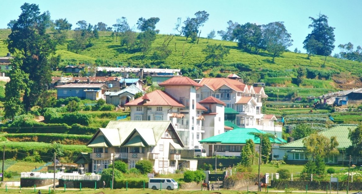
"From taro cultivation in Bogor to village tourism in Banyumas, every village has a story worth telling — and an opportunity worth sharing."
Seven areas of village knowledge
FolderDesa organizes its articles across these interconnected topics, each one grounded in real Indonesian village experience.
What you'll find on FolderDesa
Practical articles written by contributors who understand village life.
Agriculture & Cultivation
Articles on taro (talas bogor), dragon fruit, crystal guava, durian, oyster mushrooms, and tabulampot grapes — plus livestock such as dairy goats and Merino sheep.
Village-Owned Enterprises
Guides on establishing BUMDes, the differences from cooperatives, and why professional phased management matters for village economic growth.
Village Tourism
Coverage of destinations like Desa Karangkemiri in Banyumas, where outbound activities and a swimming pool helped tourism contribute Rp 50 million to village income in 2021.
Culinary Traditions
Indonesian village foods, Sundanese heritage dishes, spiced drinks, infused waters, seafood street-food ideas, and home-industry snack production.
Business Opportunities
From dried wood ear mushrooms and kopyor coconut seedlings to ecoprint crafting, bamboo crafts, and mina padi integrated rice-fish farming.
Village News & Community
Reports on social assistance programs like PKH, village governance structures, and practical tips such as safe homecoming travel during mudik season.
Creating a village map for tourist guides and residents
A clear village map can do more than show roads. It can help visitors find a waterfall, guide residents to public services, direct customers toward local businesses, and give village officials a practical picture of development needs. When designed carefully, a community map becomes a shared reference for tourism and everyday life.
Many Indonesian villages already have useful information scattered across noticeboards, social media posts, government documents, and residents’ memories. Bringing these details together creates a local navigation tool that is easier to understand and update.
The strongest maps are made with the community, rather than produced only from outside data. Farmers, youth groups, tourism managers, traders, neighborhood leaders, and village officials each know different parts of the area. Their knowledge can make the final map more accurate and relevant.
Why a village map matters
Tourists often need simple answers: Where is the entrance to the attraction? Which road is suitable for motorcycles? Is there a homestay nearby? Where can visitors eat, park, pray, or buy local products? A map that answers these questions can improve the visitor experience and encourage people to stay longer.
Residents benefit in practical ways as well. A local map can mark the village office, schools, clinics, markets, worship places, clean-water points, waste facilities, evacuation routes, and public transport stops. It can also show farming areas, craft centers, fishing locations, and community meeting spaces without exposing sensitive private information.
A useful map supports local economic development because it makes small businesses visible. Food stalls, farm shops, guides, boat operators, workshops, and accommodation providers can be included with permission. Clear location information reduces the chance that visitors will pass through the village without discovering its products and services.
Gather information from the community
Begin with a walking survey and a basic village sketch. Record roads, footpaths, rivers, bridges, slopes, rice fields, gardens, forest edges, attractions, and settlement areas. A smartphone with GPS can help capture coordinates, but local knowledge remains essential for identifying informal paths and seasonal changes.
Invite representatives from different groups to review the information. Older residents may know historic sites and traditional routes, while young people can help with digital mapping and photography. Women’s groups, farmers, disability advocates, and business owners can identify facilities or access problems that might otherwise be overlooked.
Separate confirmed information from details that still need verification. For example, a path may be passable only during the dry season, or a waterfall may require a local guide. Adding practical notes is more helpful than presenting every route as equally safe and accessible.
Choose the right map format
A printed visitor map should be simple, readable, and durable. A digital version can provide more detail, location pins, photographs, contact numbers, and links to navigation applications. Villages with limited internet access should consider using both formats so that residents and visitors are not dependent on a mobile signal.
Scale also matters. A tourism map may focus on the main settlement and attractions, while a wider administrative map can show hamlets, agricultural zones, and connections to neighboring villages. Trying to include every detail on one page often makes the result confusing.
| Map element | Useful for visitors | Useful for residents |
|---|---|---|
| Main roads and paths | Finding attractions and parking | Daily travel and emergency access |
| Public facilities | Locating toilets, clinics, and worship places | Understanding service coverage |
| Local businesses | Discovering food, crafts, and stays | Promoting village income |
| Natural features | Planning walks and scenic routes | Land awareness and conservation |
| Emergency points | Finding help quickly | Disaster preparedness |
| Contact information | Booking guides or accommodation | Coordinating local services |
Use a clear legend, consistent symbols, readable labels, and strong contrast. Avoid filling the map with decorative details that compete with important directions. A north arrow, scale indicator, date of revision, and map-maker contact should be included.
Design for tourists and daily life
A tourist guide map should highlight routes and landmarks in a logical order. Show the arrival point first, followed by parking areas, information centers, attractions, food services, accommodation, and exit routes. If an attraction requires a guide or special equipment, place that information near the relevant symbol.
Residents may need a different layer of information. Public services, administrative boundaries, waste collection areas, agricultural roads, flood-prone zones, and evacuation points can be shown in a community edition. A single digital map may contain several layers, while printed versions can be tailored to different audiences.
Accessibility should be considered from the beginning. Mark steep paths, uneven surfaces, stairs, narrow bridges, and routes suitable for wheelchairs or older visitors. Use local language where appropriate, while adding English names for important attractions if the village receives international travelers.
Accommodation is another important feature. Homestay owners should confirm their exact location, facilities, rates, and booking contact before publication. Villages developing this sector can refer to this homestay registration guide to connect mapping work with proper tourism administration.
Keep the map accurate and trusted
A map quickly loses value when roads change, businesses close, phone numbers become inactive, or a new attraction opens. Assign a small team to review the map every three to six months and after major infrastructure projects. The village secretary, tourism group, youth volunteers, and BUMDes can share responsibility for updates.
Create a simple reporting method. A QR code, WhatsApp number, or suggestion box can allow residents and visitors to submit corrections. Every change should be checked by someone familiar with the location before it is added to the official version.
Privacy and safety require careful judgment. Do not publish private homes, vulnerable cultural sites, restricted areas, or exact locations of valuable natural resources without approval. Ask businesses and residents for consent before displaying personal numbers, photographs, or property details.
Turn the map into a village asset
The map can support a wider visitor route rather than a single attraction. For example, a walking circuit might connect a traditional kitchen, a rice-field viewpoint, a craft workshop, a homestay, and a local food stall. This spreads visitor spending and gives residents a reason to protect the landscape and cultural activities represented on the map.
A BUMDes can manage printing, sponsored map panels, guide bookings, digital listings, or paid walking tours. Villages considering this business structure can review the steps to start a village BUMDes before assigning the map project to an enterprise unit.
Practical steps before publication
Before releasing the map, the working team should:
- Walk every major route and verify names, distances, access conditions, and safety notes.
- Hold a community review meeting with residents, businesses, tourism groups, and village officials.
- Prepare separate visitor and resident versions when their information needs differ.
- Ask permission before publishing private contacts, photographs, or business locations.
- Set a review date and identify the person or organization responsible for updates.
Print a small trial batch and test it with people who do not know the village well. If they can find the market, attraction, public toilet, and exit road without assistance, the design is probably clear. Gather their comments, correct errors, and then distribute the map through the village office, homestays, attractions, schools, shops, and digital channels.
A well-made map turns local knowledge into a practical public resource. Start with one accurate version, involve the people who use the roads every day, and keep improving it as the village changes. The result can guide visitors, support local businesses, and help residents see their own community with greater clarity.

Questions or story ideas from your village?
FolderDesa welcomes readers who want to share village experiences or learn more about the topics covered on the site.
Visit the Contact Page